
Ontario severe storm risk builds as U.S. faces tornado outbreak
A Colorado low will trigger a major severe weather outbreak across the U.S. on Wednesday. Storms could spill into southwestern Ontario
While some areas deal with a risk for freezing rain and snow, folks in southwestern Ontario should closely monitor potential watches and warnings late Wednesday as a risk for severe weather builds across the region.
This severe weather potential arrives as a powerful Colorado low threatens to produce a high-risk tornado outbreak south of the border.
Gusty winds are likely across southwestern Ontario even outside of any thunderstorms that develop. Wind gusts could exceed 80 km/h at times.
DON’T MISS: High-risk U.S. severe weather days are exceptionally rare and dangerous
Wednesday storm risk develops
A Colorado low tracking into the Great Lakes region will bring the whole spectrum of active weather to Ontario through the middle of the week. Freezing rain and snow could affect areas where more than 200,000 customers remain without power from this past weekend’s ice storm.

This low will push a warm front into southwestern Ontario through the late morning and early afternoon hours Wednesday, bringing a small chance for thunder as it moves into the region.
Strong winds will develop from the south and southwest as the front arrives, leading to wind gusts of 50-70 km/h. Very strong winds just above the surface could lead to gusts exceeding 80 km/h at times.

Meanwhile, a cold front sliding in from the west will start to move into southwestern Ontario during the evening and early overnight hours, leading to a risk for thunderstorms across the area. Some of these storms could turn severe, especially close to the Michigan border.
Cold waters in the lakes themselves will reduce the severity of any storms that have to cross the lakes, leaving the greatest risk for severe storms in extreme southwestern Ontario around Windsor, Leamington, Chatham, and up into Sarnia.
Strong wind gusts and heavy rainfall are the predominant threats with the strongest thunderstorms. It’s worth noting there’s a small, conditional threat for tornadoes if enough energy is able to move into southwestern Ontario from Michigan.
90,000,000+ at risk south of the border
Ontario’s thunderstorm risk arrives on the very northern end of a widespread severe thunderstorm outbreak expected across the United States on Wednesday.
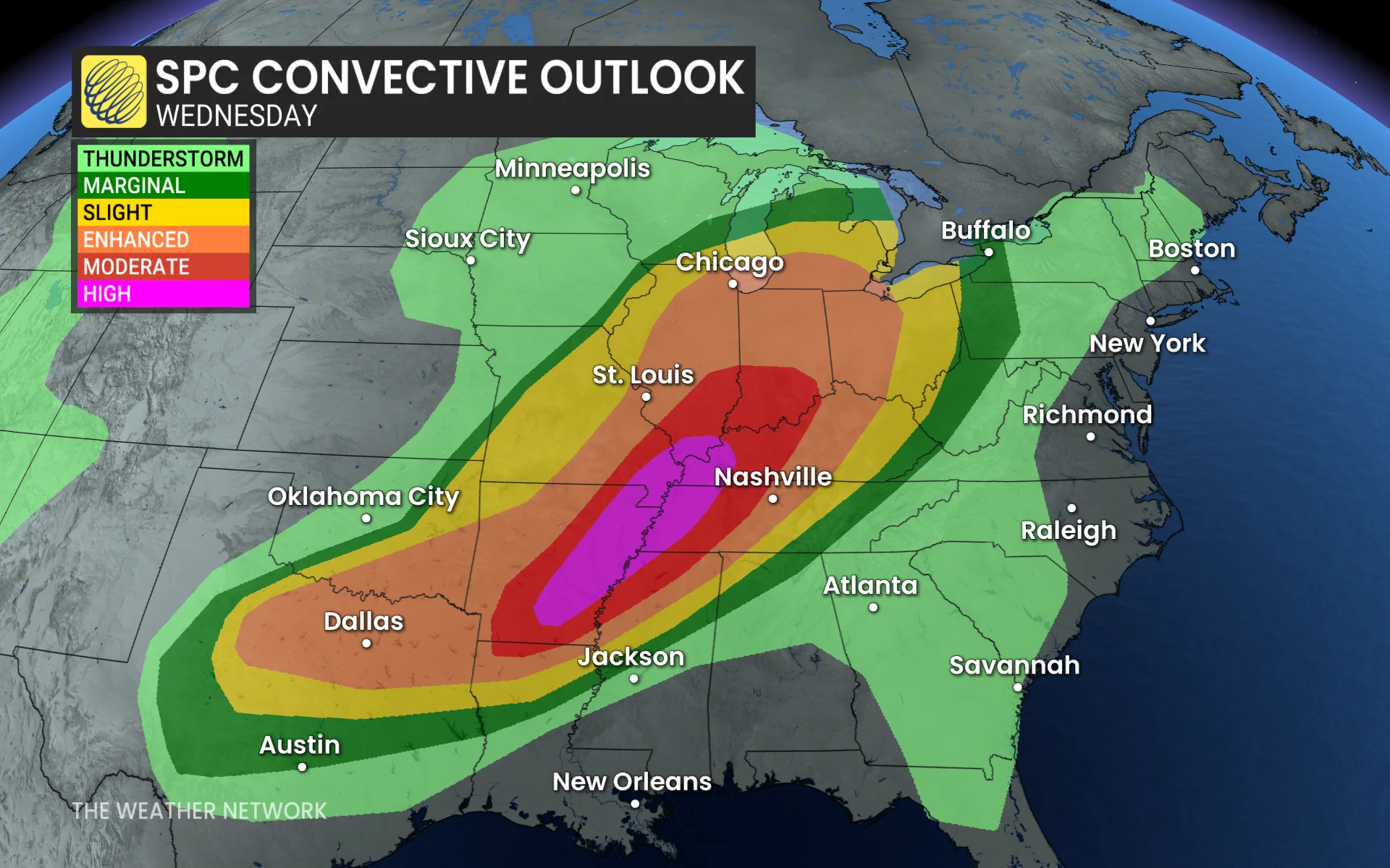
The potential for severe weather covers nearly 100,000,000 people south of the border, with dangerous thunderstorms possible from central Texas all the way north into western New York. Expect dangerous highway travel and disrupted airline travel throughout many major hubs.
The strongest U.S. thunderstorms are capable of producing 120+ km/h wind gusts, hail the size of golf balls or larger, and tornadoes.
RELATED: How supercells grow to produce giant hail and intense tornadoes
A full-blown tornado outbreak is possible for some regions. The U.S. Storm Prediction Center (SPC) issued a high risk for severe weather—a level five out of five—for portions of the Mid-South, including the city of Memphis, Tennessee.
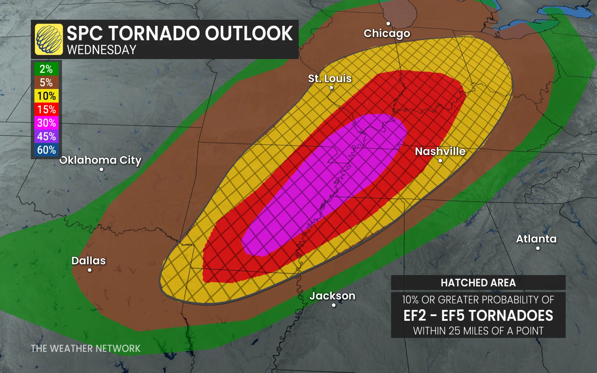
“Numerous tornadoes, along with multiple long-track EF3+ tornadoes appear likely” across the high-risk areas, the SPC said in its overnight forecast.
U.S. forecasters reserve issuing a high risk for severe weather for days they’re extremely confident in a tornado outbreak. On average, the SPC only issues one or two high risks per year—and sometimes entire years pass between severe weather setups that warrant such a forecast. Wednesday is only the 67th high-risk day in the U.S. since Jan. 1, 2000.
A major flooding threat will develop through the weekend across many of the same areas expecting significant storms on Wednesday. The U.S. Weather Prediction Center (WPC) warned that “a prolonged life-threatening flash flood event will begin today with several days of heavy rainfall impacting a large portion of the Lower Mississippi and Ohio valleys.”