Earthquake, The Silent Threat Beneath Our Feet – From U.S To Japan To India. The $1.8 Trillion Megaquake, Warns Japan And Indian Subcontinent? Not If, But When!

The ground beneath our feet is never truly still and on Friday, Myanmar bore the brunt of that unsettling truth when a powerful 7.7-magnitude earthquake struck near Mandalay, toppling buildings and claiming over 2,000 lives.
Myanmar sits on a highly volatile seismic zone, but what shocked many was how far the tremors were felt – bringing devastation as far as Bangkok, over 1,000 kilometers away.
What makes this earthquake particularly alarming is the bigger picture. Myanmar’s quake was one of three powerful temblors to shake the Indo-Pacific region in just a week.
It all started on Tuesday last week, when a magnitude 6.8 earthquake rocked New Zealand’s South Island, triggering a small tsunami. Then came Friday’s deadly quake in Myanmar, followed by another tremor early Monday morning, this time near Tonga.
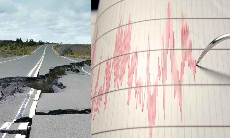
While these earthquakes didn’t directly trigger each other, they are all part of the same complex system of tectonic plates that constantly shift and grind beneath the Earth’s surface. This movement is the very force that shapes mountains, causes volcanic eruptions, and when pressure is suddenly released generates earthquakes.

Why Myanmar? The Dangerous Convergence of Tectonic Plates
Myanmar is one of the most geologically unstable regions on the planet. It sits precariously on the meeting point of four massive tectonic plates – the Eurasian plate, the Indian plate, the Sunda plate, and the Burma microplate. The collision of the Indian and Eurasian plates gave birth to the mighty Himalayas, and the infamous 2004 tsunami was caused by the Indian plate plunging beneath the Burma microplate.
Adding to Myanmar’s seismic vulnerability is the Sagaing Fault – a 1,200 km-long fault line slicing through the country from north to south. Friday’s earthquake appears to be linked to this fault, following a classic “strike-slip” movement, where two massive blocks of rock slide horizontally past each other, storing immense energy until it suddenly ruptures.
Why Was the Quake Felt So Far Away?
Earthquake, this one, occurring at a depth of just 10km, was a “shallow” quake, meaning the energy had nowhere to go but outward – causing extreme surface shaking and the bigger the quake, the farther that energy travels.
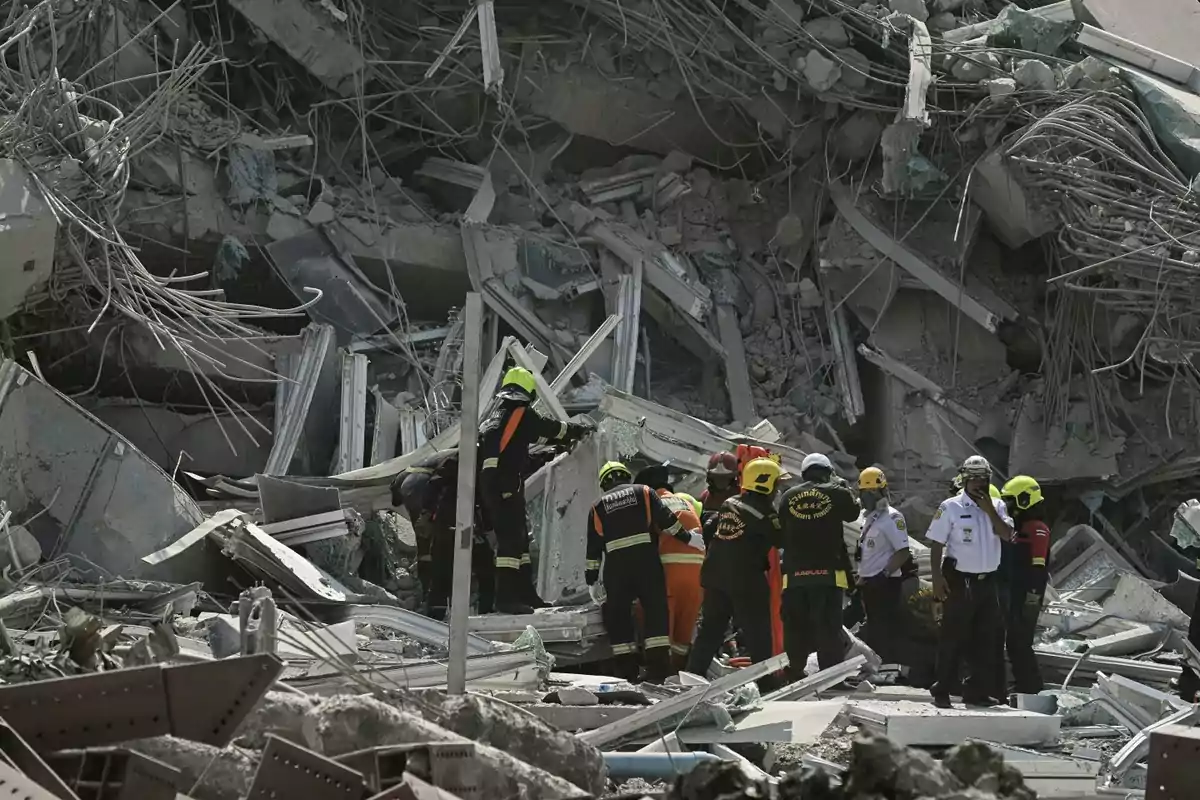
Seismologists also believe this was a rare “super shear” earthquake – where the rupture moved faster than seismic waves can travel, much like a supersonic jet. This means the energy from the quake did not radiate out evenly, it was directed in a specific direction, which in this case was south, straight toward Thailand. This is why Bangkok, despite being more than 1,000 km away, saw an unfinished high-rise crumble.
Bangkok’s Hidden Risk
The Thai capital is not typically seen as an earthquake hotspot, yet it experienced surprisingly intense shaking. The reason is it’s very foundation. Bangkok is built on soft, swampy soil, which amplifies seismic waves, unlike bedrock, which absorbs and disperses energy, soft soil slows down seismic waves, making them grow in intensity – like a ripple turning into a tidal wave.
Hence, if a future megaquake strikes closer to Bangkok, the damage could be far worse than expected.

The Really Big One For America
In 2011, when the devastating earthquake and tsunami struck Japan’s Tohoku region, seismologist Chris Goldfinger, who was attending a seismology conference, knew immediately that something significant was happening. The duration of the shaking – which lasted for about four minutes – gave a clear indicator of the magnitude, eventually revealed to be a 9.0 earthquake.
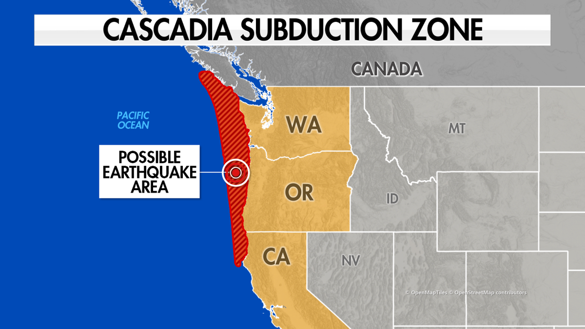
Goldfinger, a paleoseismologist at Oregon State University, was not only concerned with the Tohoku event. For him, this massive earthquake was a precursor to another, potentially more catastrophic event awaiting the Pacific Northwest of the United States: The “big one” from the Cascadia Subduction Zone.
While many in the U.S. associate earthquake risk with California’s famous San Andreas Fault, Goldfinger’s focus lies on the Cascadia Subduction Zone – running 700 miles off the Pacific Northwest coast, this fault represents an area where one tectonic plate, the Juan de Fuca Plate, slides under the North American Plate.
Over time, the area where these two plates meet becomes stuck due to pressure, with the land mass of North America slowly bulging and compressing. This process can continue for years until, inevitably, the tension is released in a massive earthquake.
When this happens, it could result in a magnitude of 8.0 to 8.6 for a smaller rupture. However, a full-margin rupture – where the entire zone slips simultaneously – would produce an earthquake ranging from 8.7 to 9.2.
The consequences of such an event are staggering. The Pacific Northwest would drop by up to six feet and experience a rebound of up to a hundred feet. As the land shifts, it would trigger a colossal tsunami, traveling as far as Japan in one direction and toward the U.S. West Coast in the other.
This seismic event would affect 140,000 square miles, including major cities like Seattle, Portland, and Vancouver, impacting seven million people. In the aftermath, FEMA estimates that up to 13,000 people would die, and another 27,000 would be injured. The destruction would be unprecedented in North America, ranking it alongside the 2010 Haiti earthquake as one of the worst natural disasters in modern history.
For years, the Cascadia Subduction Zone was largely unknown to most people, and even experts only recognized its seismic potential relatively recently.
Today, research by Goldfinger and others suggests that the probability of a significant earthquake happening in the next 50 years is about one in three. The risk of an even larger, more devastating event is about one in ten. Despite this growing awareness, the Pacific Northwest remains woefully unprepared for such a disaster.
The region’s unpreparedness is concerning, given the historical lack of knowledge about the Cascadia Subduction Zone and the increasing scientific confidence in the likelihood of the “big one.” Goldfinger’s work continues to shed light on the region’s seismic vulnerabilities, but many fear that, despite these warnings, the necessary preparations may not be in place until it’s too late

Japan’s Megaquake Warning
Japan is at high risk of a devastating megaquake along the Nankai Trough, a seismic zone off its southwest coast, with the potential to cause up to $1.81 trillion in damage and result in the loss of about 300,000 lives, according to a recent government report. This figure represents nearly half of the country’s GDP, a sharp increase from previous estimates due to updated data that includes inflation and expanded flood zones.
The Nankai Trough, where the Philippine Sea Plate is subducting under the Eurasian Plate, stretches roughly 900 km off Japan’s coast. Seismologists predict a 80% likelihood of a magnitude 8 to 9 earthquake occurring there, potentially causing massive tsunamis, building collapses, and widespread devastation. In the worst-case scenario, a magnitude 9 earthquake could lead to the evacuation of 1.23 million people, or about 1% of Japan’s population, and cause the deaths of up to 298,000 people, particularly if the quake strikes at night during winter.
This region experiences tectonic strains that could produce such a megaquake once every 100 to 150 years. Japan’s government recently issued a megaquake advisory following a 7.1 magnitude quake near the trough, signaling an increased likelihood of a larger earthquake. The aftermath would mirror the catastrophic effects of the 2011 earthquake and tsunami, which caused more than 15,000 deaths and triggered nuclear disasters.
Indian Subcontinent
The Indian subcontinent, encompassing India, Nepal, Bhutan, Bangladesh, and parts of Pakistan, is situated atop a complex tectonic setting, making it highly susceptible to earthquakes. This seismic activity is primarily attributed to the ongoing collision between the Indian and Eurasian tectonic plates, a process that has shaped the region’s geological terrain over millions of years.
The subcontinent has experienced several significant earthquakes throughout its history. Notable among them are –
—2001 Gujarat (Bhuj) Earthquake: Occurred on January 26, 2001, with a magnitude of 7.7, resulting in approximately 20,000 fatalities and extensive structural damage.
–2004 Indian Ocean Tsunami: Triggered by a magnitude 9.1 earthquake off the coast of Sumatra, Indonesia, the tsunami affected coastal regions of India, particularly Tamil Nadu, causing over 10,000 deaths.
–2015 Nepal Earthquake: A magnitude 7.8 earthquake that devastated Nepal and affected parts of northern India, resulting in thousands of deaths and widespread destruction.
Studies suggest that large earthquakes in the Kashmir Himalaya occur with a recurrence interval between 500 and 700 years. The last major event was the 1555 Kashmir earthquake, indicating that the region may be due for another significant quake.
Research indicates that earthquakes in northeast India have a recurrence interval of approximately 7.82 years, indicating the region’s high seismic activity.
Statistical analyses reveal that earthquakes with a magnitude of 7 or greater occur in India approximately every nine years, while those with a magnitude of 6 occur every four years.
These recurrence intervals show the persistent seismic risk faced by the Indian subcontinent. The region’s complex tectonic interactions, particularly the collision between the Indian and Eurasian plates, continue to influence its seismic activity and understanding these patterns is crucial for disaster preparedness and risk mitigation strategies.


